WWW.KARLSWALKS.CO.UK
PICTURES AND TRIP REPORTS FROM MY WALKS IN THE ENGLISH LAKE DISTRICT
|
|
|
|
||||
|
|
|
|
|
|
|
|
E-mail - karl@karlswalks.co.uk |
Our friend Lynn was on her annual week long stay in Coniston so we arranged to meet up for a walk over Coniston Old man and Dow Crag. The forecast looked good for Saturday so I decided to have my first camp of the year and meet Sue on Sunday morning for a lift to Coniston. Unfortunately the train and bus both were delayed which meant that I didn't set foot on the fell till just before two in the afternoon so my original plan to camp above Tilberthwaite was abandoned but I still had a great couple of hours exploring an area which I'd not walked before.

AI left the 516 bus at Skelwith Bridge and had three quarters of a mile of road walking before reaching the track heading for Black Fell.With hindsight I could have followed the Cumbria way and used the farm lane from Park Farm to the road. Lovely view of Pavey Ark and Harrison Stickle from the climb away from the road.

Looking back to Loughrigg from a little further along the track.

Still extensive snow cover on Pike of Blisco, Crinkle Crags and Bowfell.

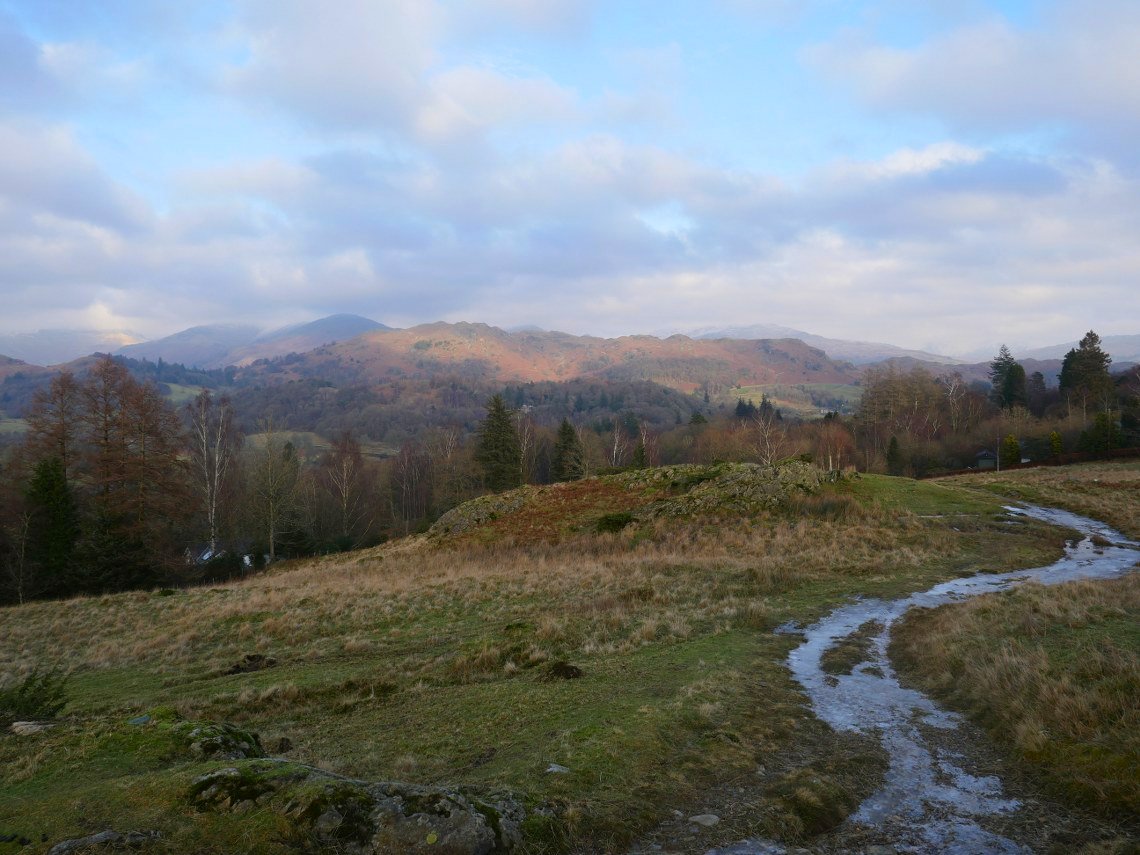
Realising that I didn't have the time to do my original route I decided to have a good look around the little bumps and hollows on Black Fell. Here I've spotted this large structure so walk across to have a look.

Which was a large cairn with a lovely view over Elterwater, Silver How, Loughrigg and the high fells of the Fairfield/Helvellyn group in the distance.

From the Cairn I headed up hill to the 284M top of Stephen How from where the view was down to a secluded little tarn with Windermere beyond that

The nameless tarn with a lone silver birch.
.
I thought this was a super little spot and was tempted to pitch by the tarn but decided it was a bit early so pushed on up the hill towards Black Fell.

I climbed a modest little knoll with the grand name of Great Cobble from where the view opened up to south into the setting sun.

And from where the lower cairn on Black Crag was well seen with Esthwaite Water in the background.

Nearing Black Crag which the top of Black fell is rather confusingly named. Tarn Hows down below.

Windermere again from the carn on Black Crag.

Leaving the top I headed downhill and across country to the small bump of Arnside Intake which is the dark top in the right foreground.

On to Arnside Intake and time to get the tent up as the temperature was dropping like a stone.

But taking time to capture the view of the low sun on the Langdale Pikes.

And a look back to Black Crag.

The cloud has cleared slightly and the distinctive cone shape of Pike of Stickle is now visible.

Pitched up and time for a brew.

Wider view of my pitch over Little Langdale, Lingmoor Fell and the Langdale Pikes.

A large bank of cloud has settled on Wetherlam. The evening was very cold and the stars were wonderful but around ten the skies clouded over and the frost melted from the tent and from then on the night was comparatively mild.

The large bank of cloud is still over Wetherlam but now is lit by the rising sun.

Which only lasted a few minutes but was lovely to see.


This was the only sun I was to see all day and by the time I had packed up grey skies had taken over.

But it was dry and not to cold as I made my descent down the side of Arnside Intake heading for High Arnside Tarn.

Which was still frozen over.

After meeting Sue and collecting Lynn from her cottage we drove up to the car park on Walna Scar Road. This is now a pay and display although all the eight pounds collected so far have not been spent on any tarmacing as the ground was as pot holed as it's always been. We set off along the "tourist" route to the Old Man. Unfortunately it's now started to drizzle.

From fairly low on the path we started to encounter ice on the paths so we all put on our spikes but we seemed to be the only people who had them and quite a few people turned back when they could get no further.

Passing the old mine workings. The drizzle and the breeze were now very cold and the climb became a bit of a trial.

Low water seen in a brief clear moment..

The path was becoming very tricky and although we were ok with our spikes a lot of people who had pressed on to try to get to the top were really struggling. And the ones who had made it to the top and were returning had to basically slide down on their bottoms.

At last we reach the summit. I had to put the camera away here as my fingers were so cold. We had a quick lunch in the lee of the cairn and headed down to Goats Hause and then up to Dow Crag which wasn't as treacherous underfoot but the mist never lifted so we had no views at all
Previous walk - High Pike and Carrock Fell - Next Walk - A Coledale round