WWW.KARLSWALKS.CO.UK
PICTURES AND TRIP REPORTS FROM MY WALKS IN THE ENGLISH LAKE DISTRICT
|
E-mail - karl@karlswalks.co.uk |
Sue ( along with Poppy dog) and I rented a holiday cottage in the pretty village of Aberdaron on the south western tip of the the Lleyn peninsula.
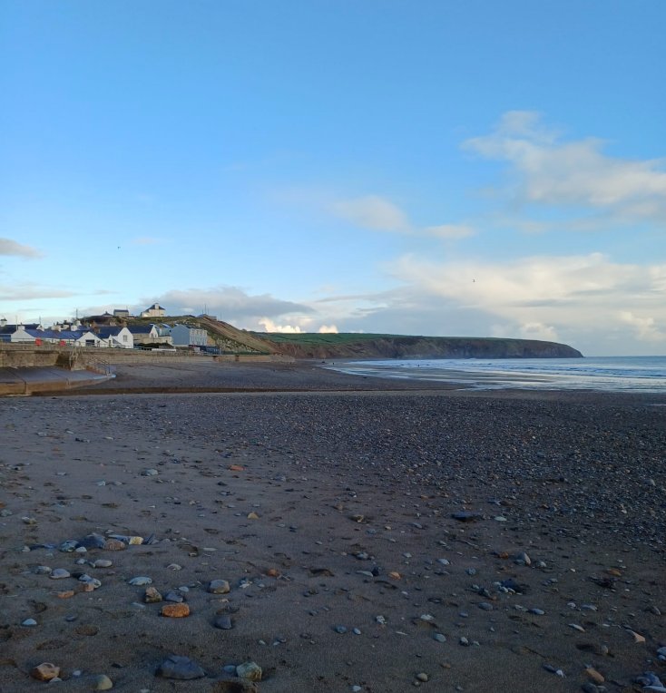
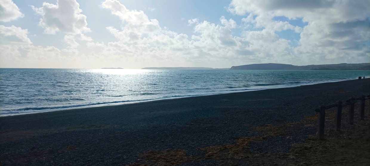
Arriving late on Friday afternoon we made the short trip from the cottage to explore the village and beach.
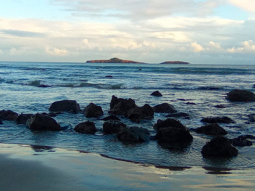
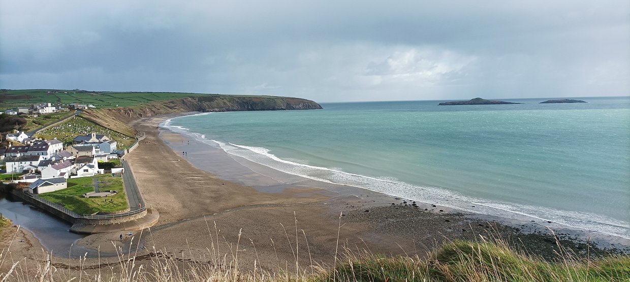
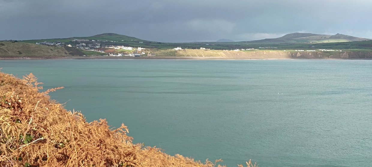
The two small islands out across from the village in Aberdaron bay. The larger one is named Ynys Gwylan-fawr and the smaller Ynys Gylan-bach.
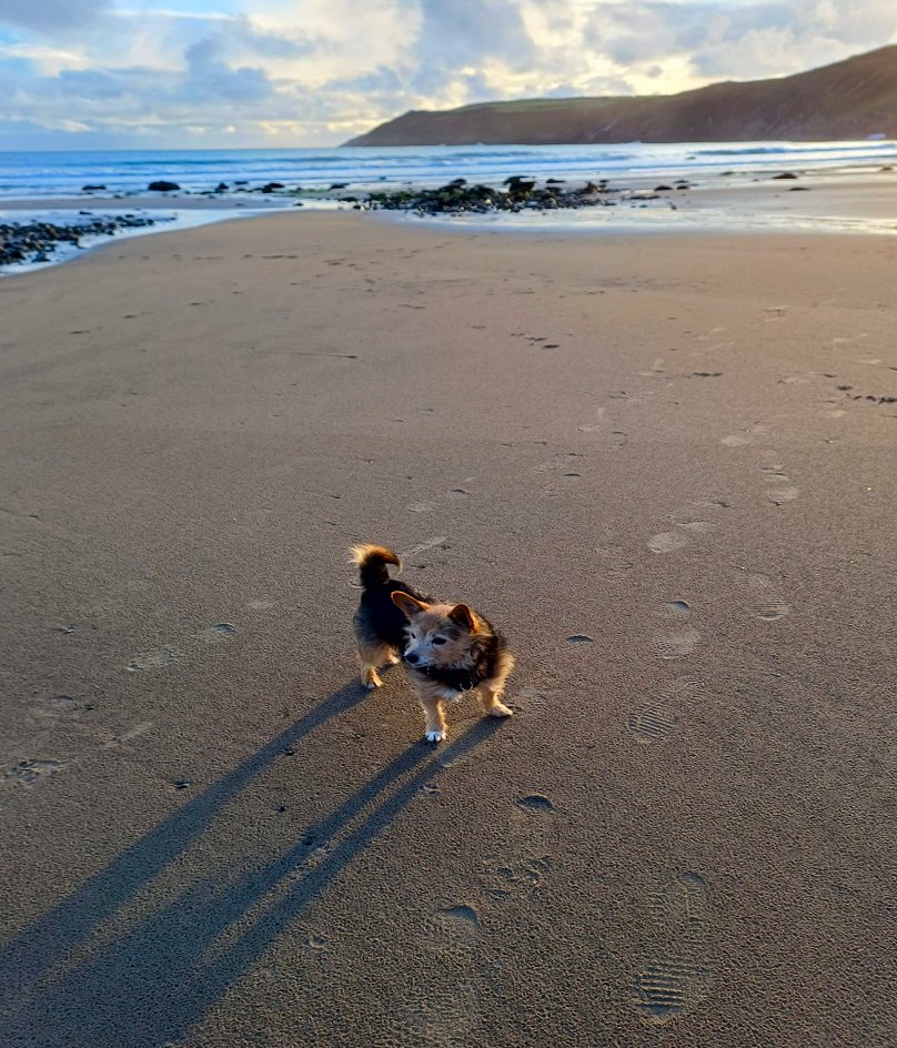
Poppy checks out her surroundings.
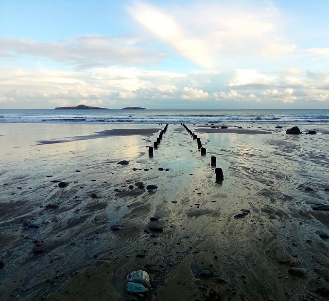
We walked for a few hundred yards along the beach till we came to these old posts running across the beach into the sea.
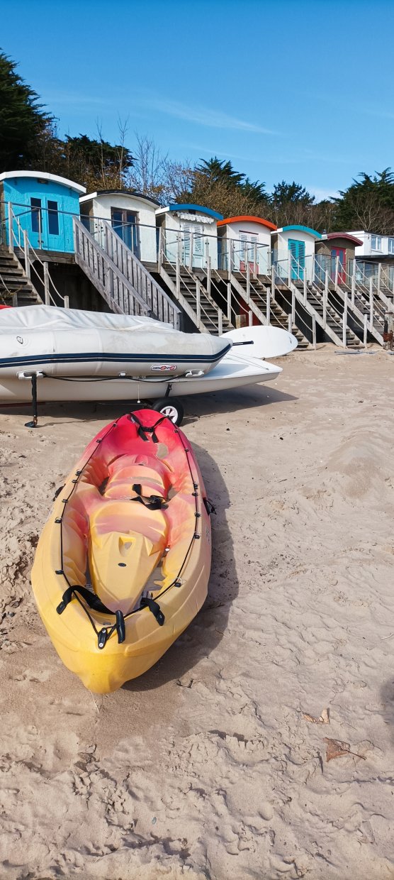
When unloading the car I found that I'd left the bag with my waterproof gear at home so the next day we had to drive to Abersoch so I could buy a jacket and waterproof trousers. Whilst we were there we had a walk on the beach which had some colourful beach huts.
.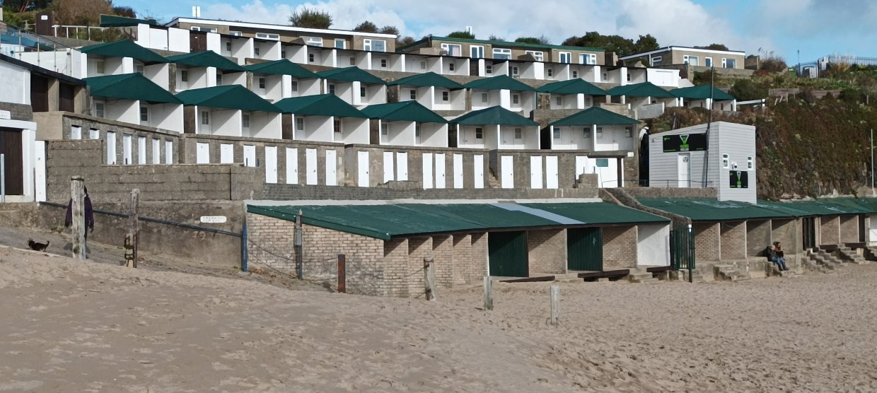
Some slightly more luxurious beach huts.
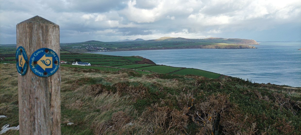
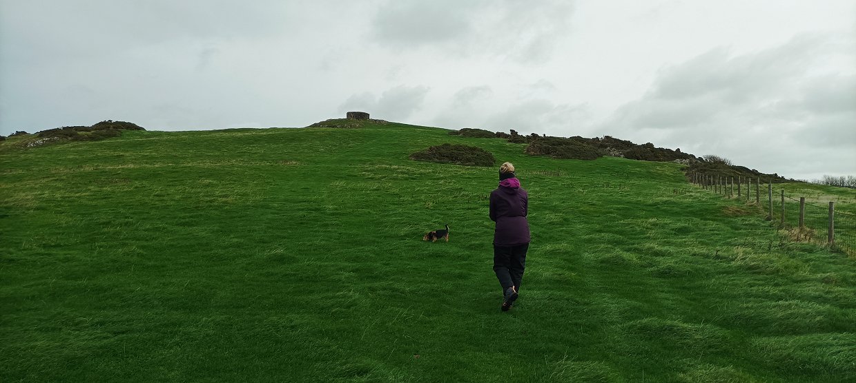
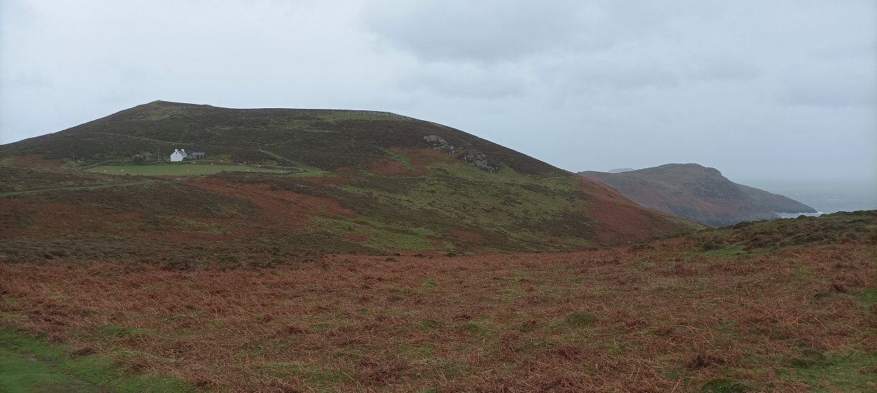
After returning to Aberdaron, Sue and Poppy spent the afternoon relaxing in the cottage whilst I had a walk on the Wales coast path which runs through the village. This is looking back from the low headland above the village.
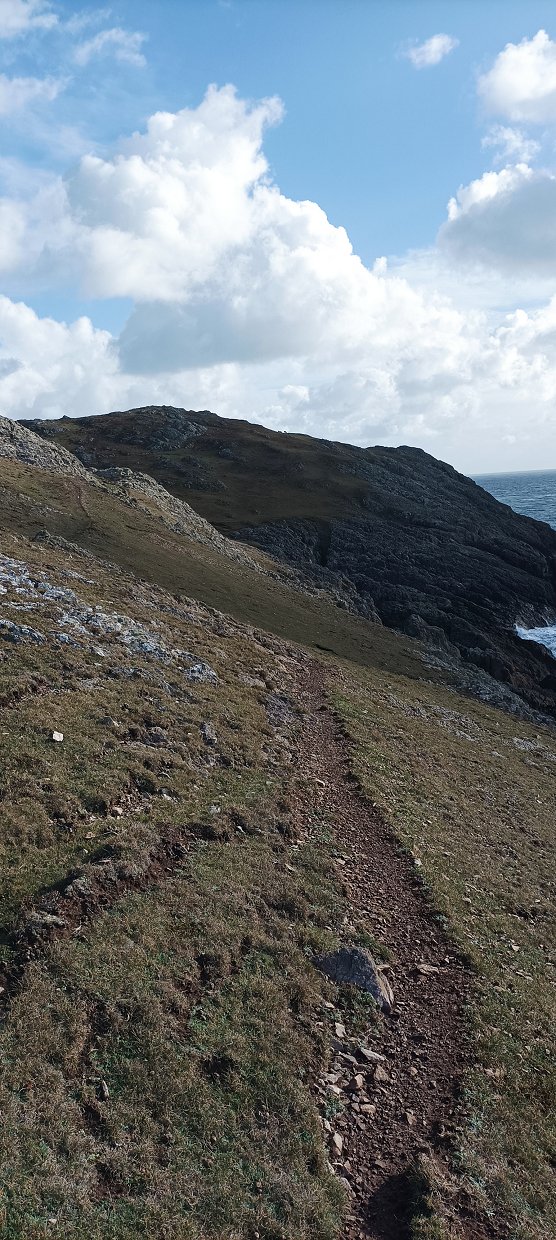
The first mile or so was typical of coastal paths with steep steps descending to a beach or cove then steep steps climbing away from it..
Looking back to Aberdaron.
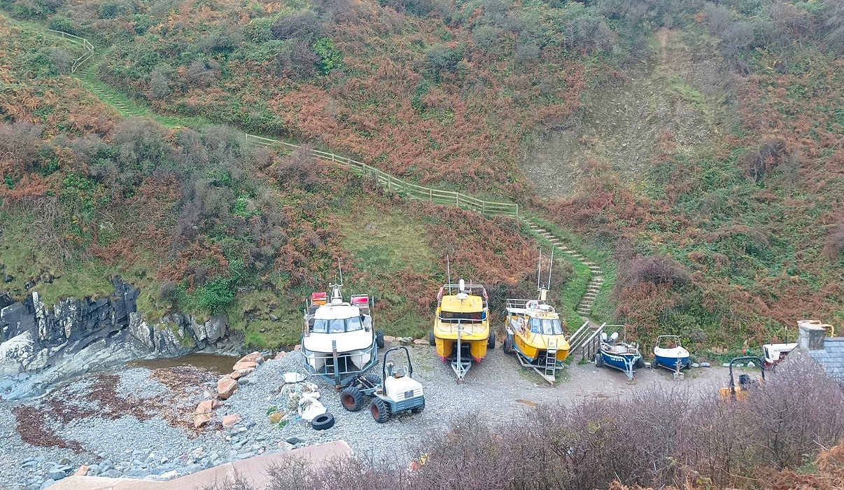
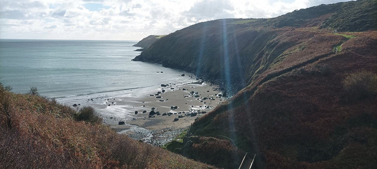
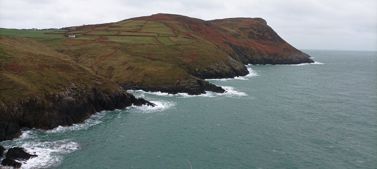
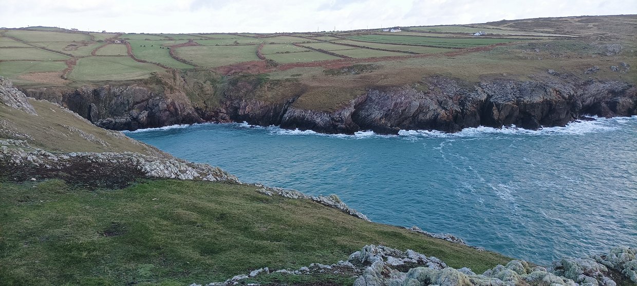
The next cove along was Porth Meudwy which has a slipway for launching boats and was used as the embarkation point for pilgrims visiting the island of Bardsey.

Down into Porth Meudwy.
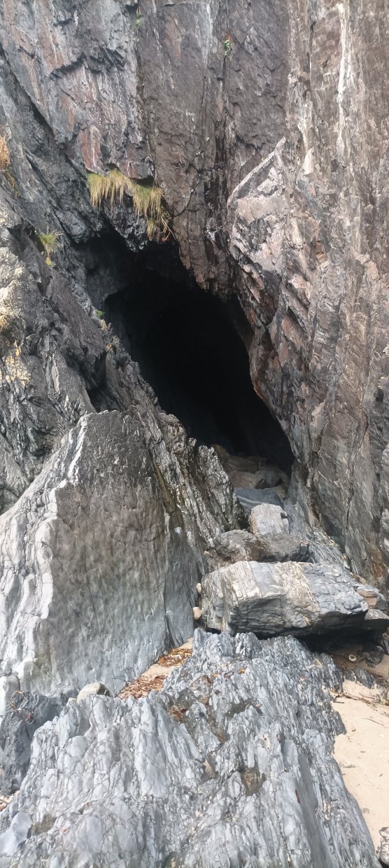
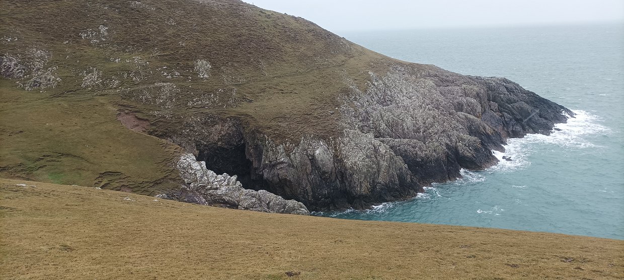
From the slipway I could see a couple of sea caves so I went and had a look at the largest.
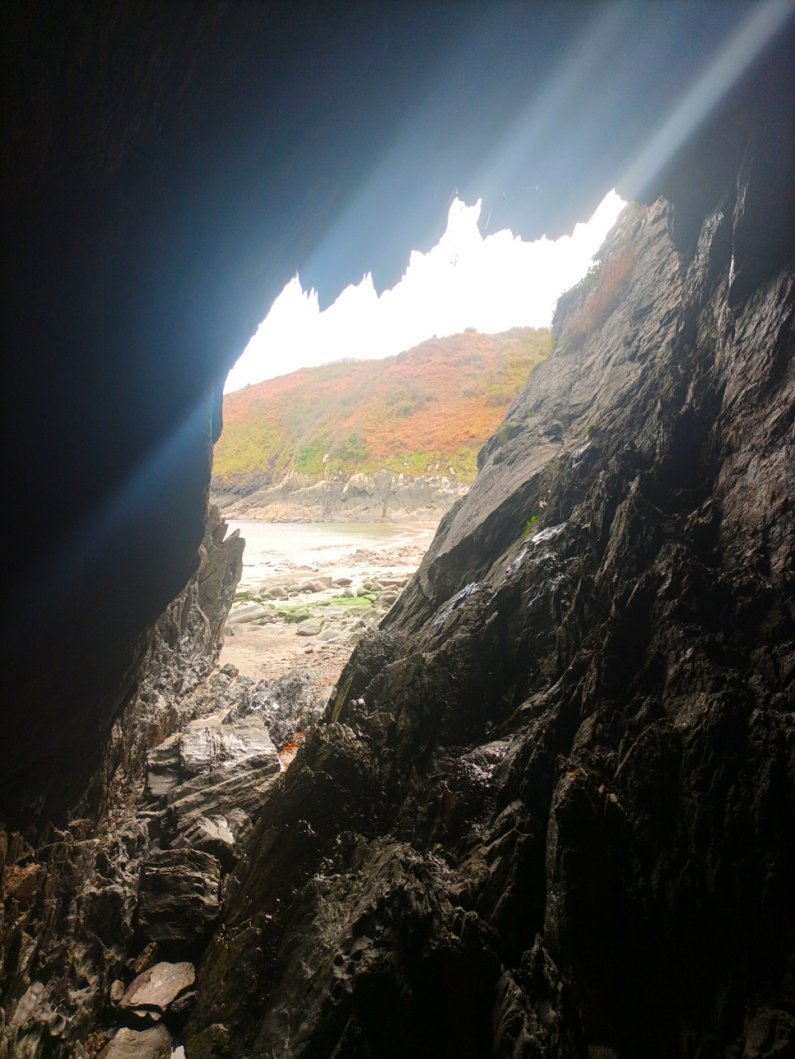
Looking out.
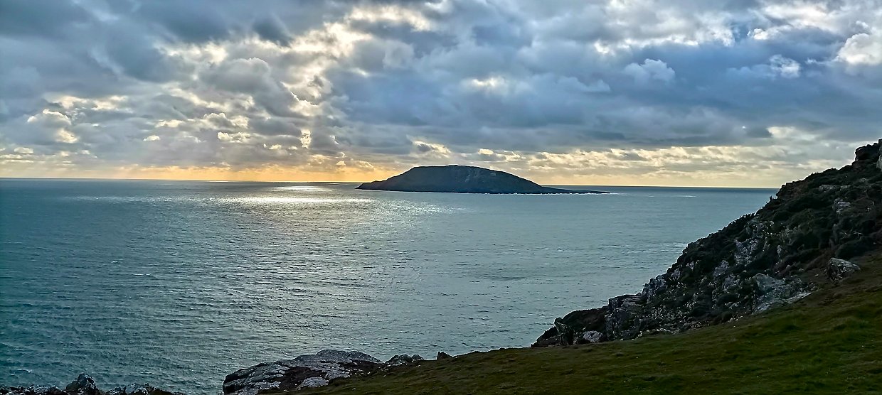
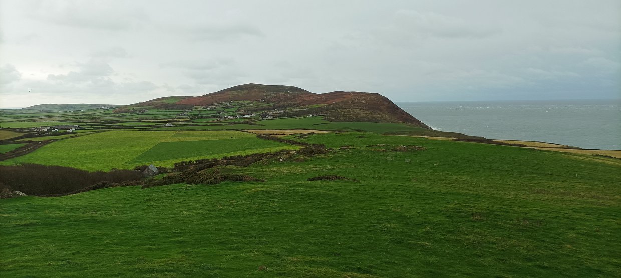
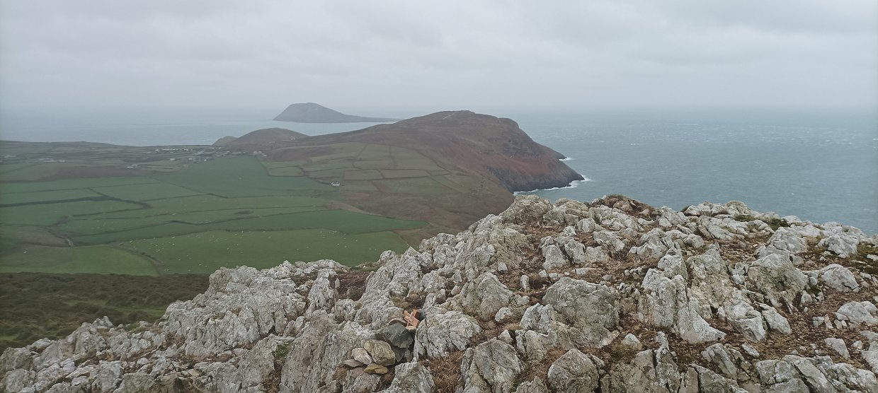
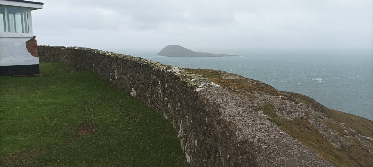
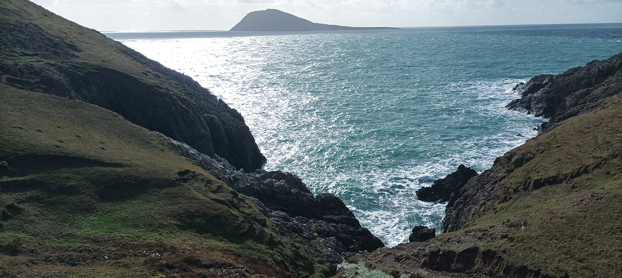
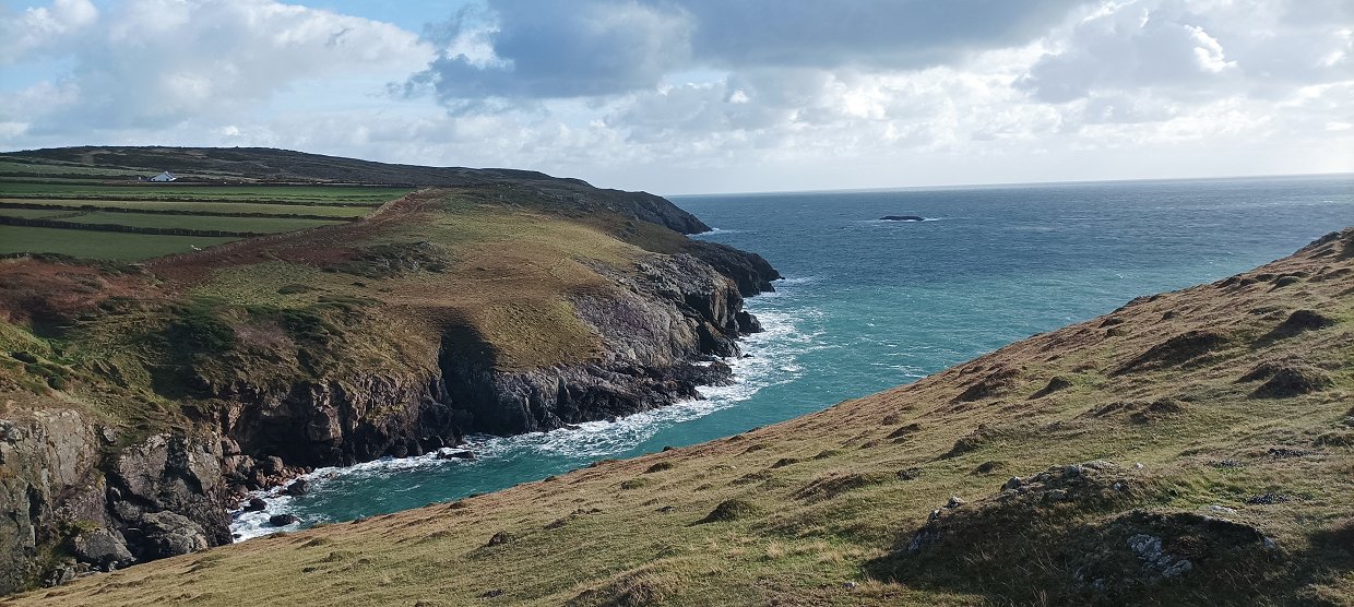
After climbing away from Porth Meudwy the path sticks ( sometimes alarmingly ) close to the edge of the cliffs before climbing to the headland of Pen y Cil from where I get my first view of the island of Bardsey.
Looking back to the peninsula from Pen y Cil. The larger hill lit by the sun is Mynydd Rhiw, next along to the left is Carn Fadryn and just further to the left are the triple tops of the Yr Eifl hills which we are visiting later in the week.
Bardsey Island with the sun setting behind. I'd walked around two and a half miles so far so which means that it's two and a half miles back and I thought that five miles is a good enough walk for an afternoon so I retraced my steps back to the cottage.
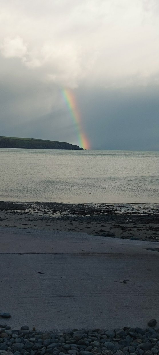
Getting to see a rainbow just as I neared home.
The next day we drove the couple of miles to the large cairn and viewpoint of Myndd Carreg from where I was going to follow the coast path back to Aberdaron which was about eight and a half miles. Sue and Poppy where having a shorter walk and returning to the car. The weather was set to deteriorate around lunch time which if it did would at least test my new jacket.
My route ahead. I think the headland in the very far left distance is Pen y Cil but I have to get over a couple of hills before I reach it.
Looking down to a great camp spot. Although I don't know if the wind ever stops blowing in from the sea, it never did when we were there.
I'm a little closer to the hills seen yesterday and it's a real shame the weather has closed in because I'd read that from Mynydd Carreg there are great views of the high mountains of Snowdonia.
The Wales coast path avoids the next hill along which is Mynydd Analog but the guide book says it's a worthwhile diversion to climb it so I did.
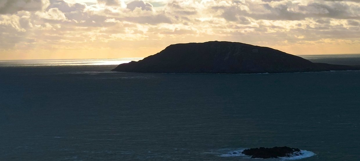
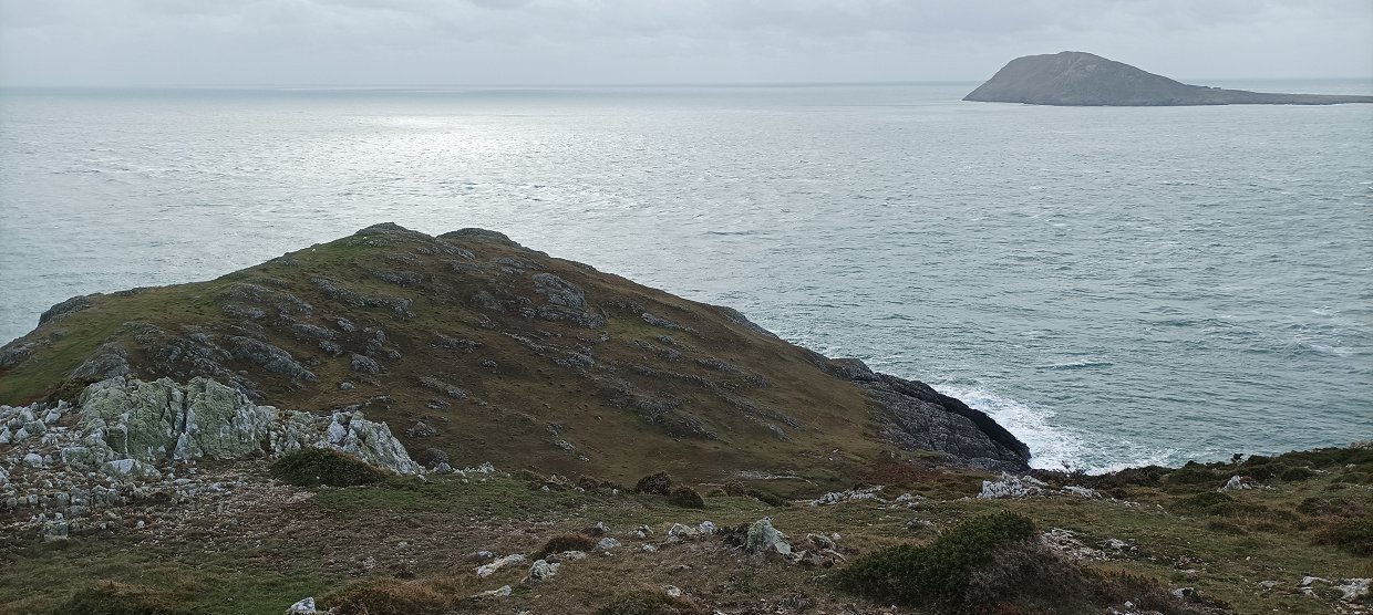
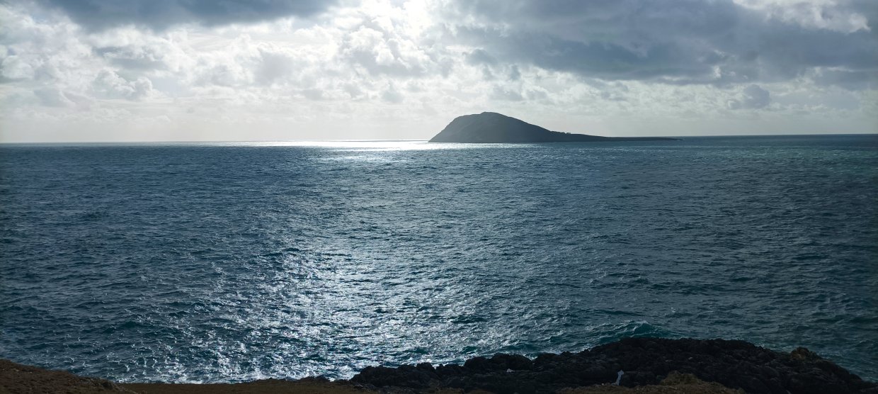
From the top I could see Bardsey Island and next in line for me was Mynyd Mawr, sometimes called the "Lands End " of Wales.
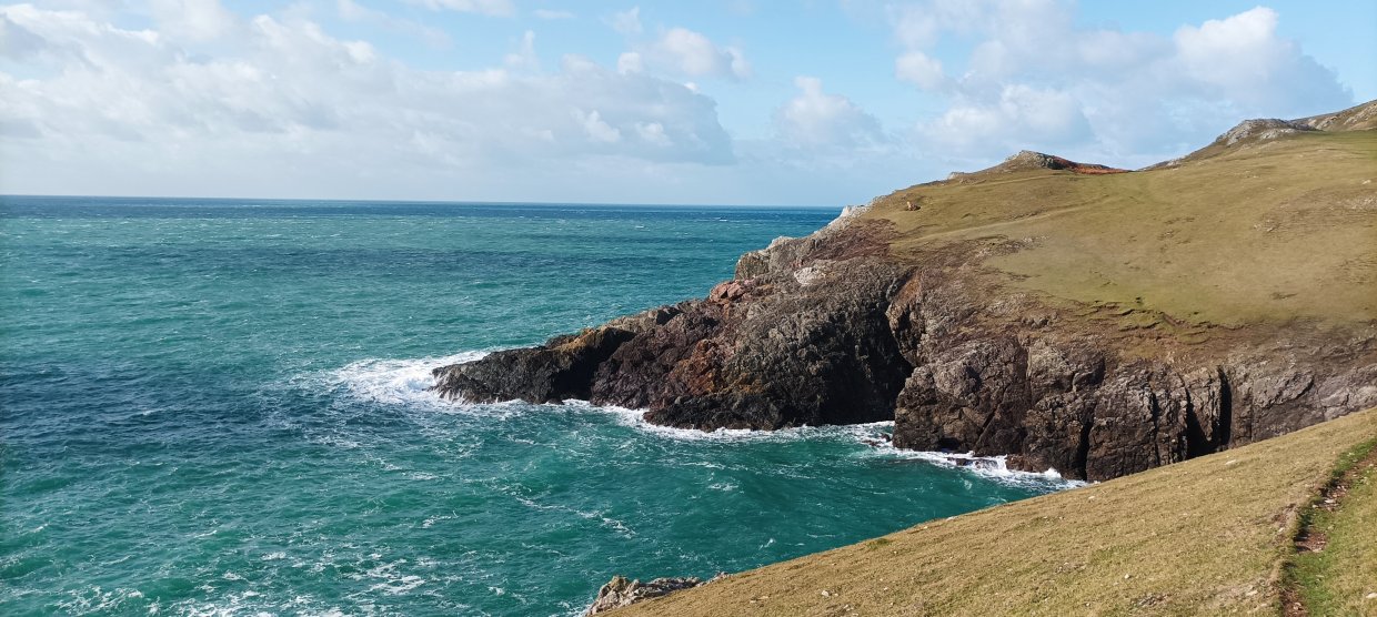
Lovely rugged coastline between the two tops which reminded very much of the north Devon coast. It's raining now but I'm glad to say that my jacket ( so far ) is up to the job.
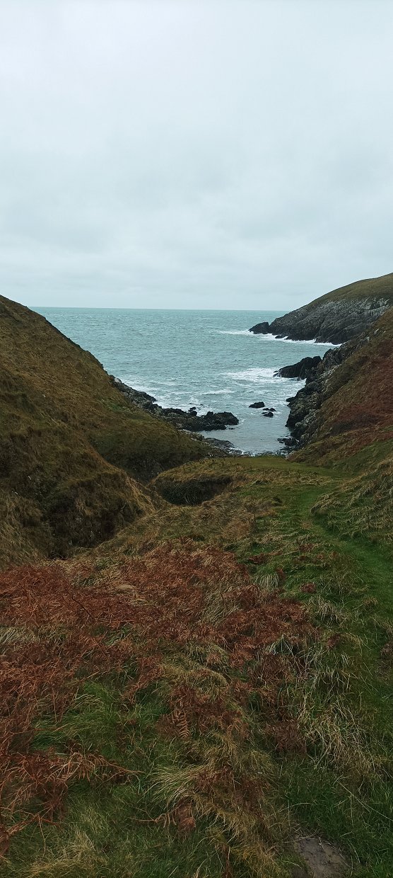
Passing the small cove of Porth Lanllawen.
Bardsey again from the top of Mynydd Mawr which has a couple of old coastguard huts and a car park.
I followed the coast path down from the top past the ruins of the WW2 radar station. I'm looking down towards St.Mary's well which is a natural spring hidden in the rocks and is one of the most holy sites in Wales, pilgrims used to bathe in it's waters before visiting Bardsey. It's also below the sea at high tide and it's not the place to go looking for in rough weather like today. From here I decided that as the rain was getting heavier and the views disappearing into the mist I would walk back along the quiet lanes, and as Sue wanted to visit Mynydd Mawr later in the week when the weather was set to improve I I would have another look then.
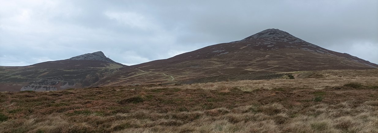
The following day was dry but windy again as we drove to the car park above the village of Llithfean to climb two of the Yr Eifl hills. From the car park you can see the main top which is called Garn Ganol ( and at 561M is the highest peak on the peninsula ) to its left is Garn For. The other top is not visible from here but that's where we are going first
Carn Fadryn seen from the other side.
The path climbs gently across the moor but we still can't see the third top.
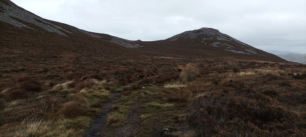
But suddenly it's revealed. Tre'r Ceiri is its name and the top is ringed by an ancient hill fort.
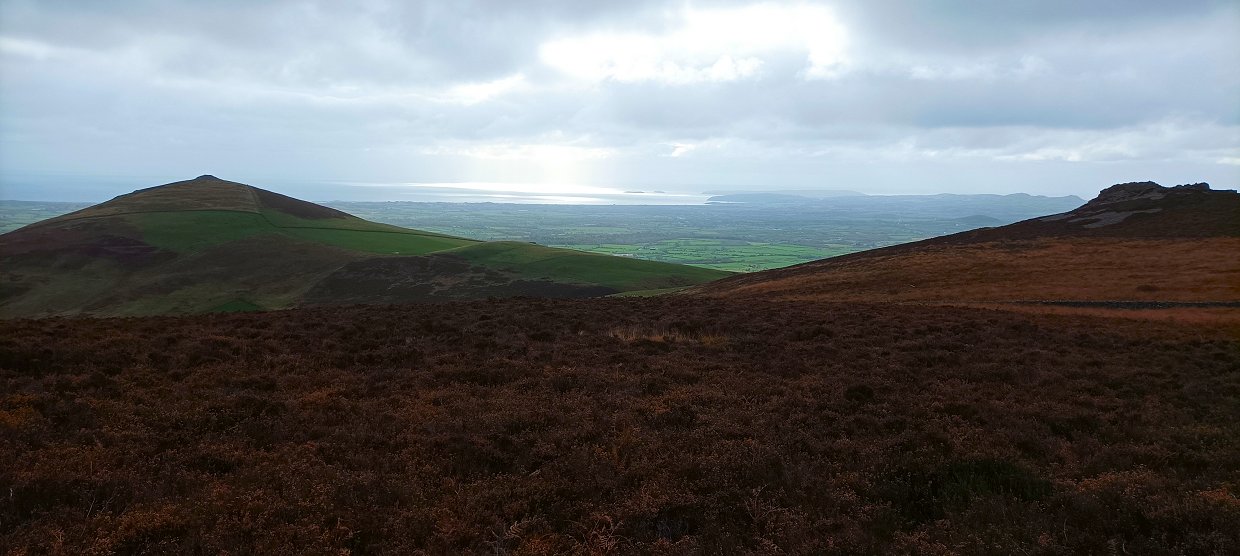
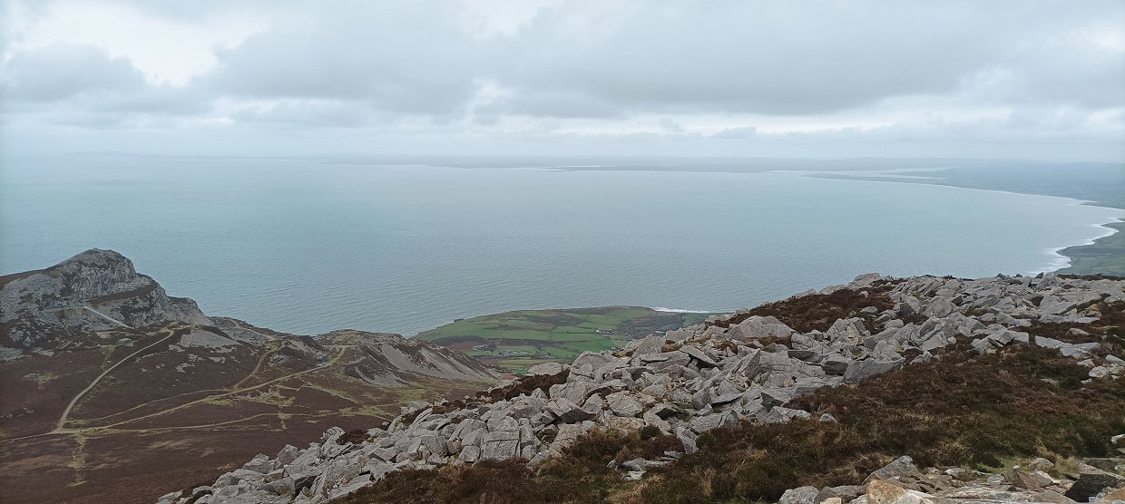
The great thing about walking on a narrow peninsula is that you're never short of a view of the sea. The grassy cairned hill is Mynydd Carnguwch and the rocky outcrop on the right is Caergribin.
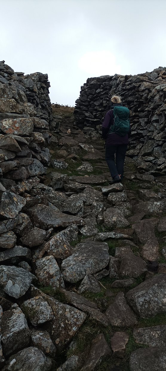
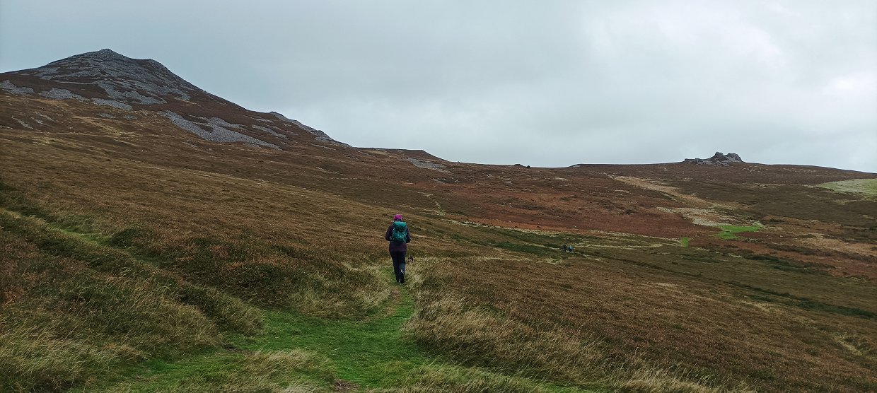
Sue storming the fort through the western gate.
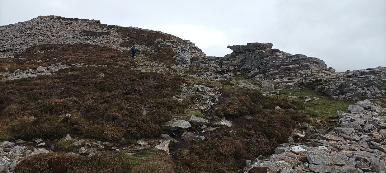
The area around the very top contains quite a few remains of huts.
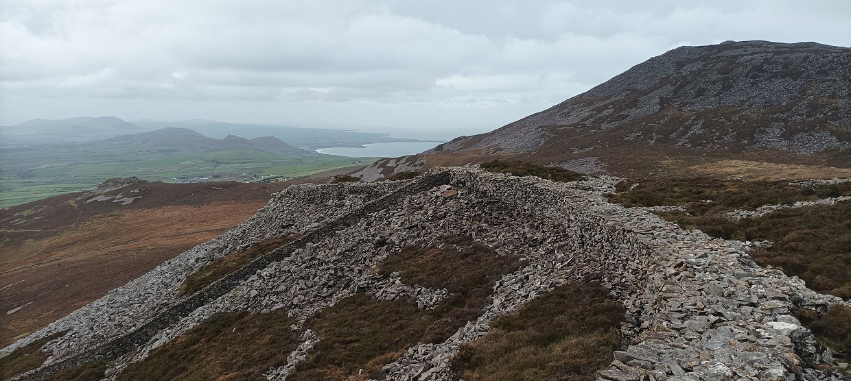
Part of the defensive wall.
The view north eastwards from the top.
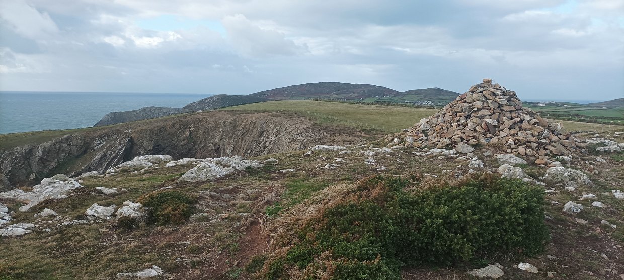
I returned with Sue as far as this cairn where the path splits, she took the path back down to the car and I carried on to climb Garn Ganol.
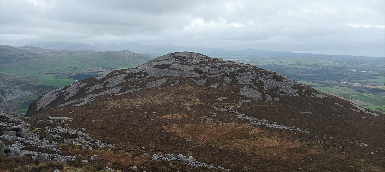
Tre'r Ceiri seen from the climb.
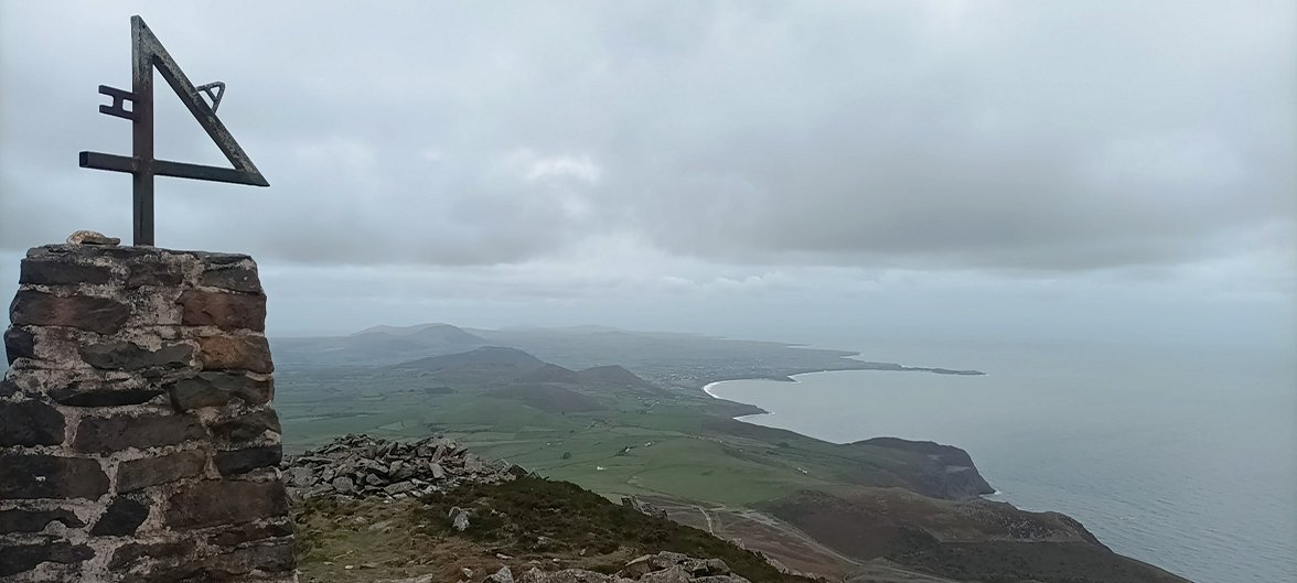
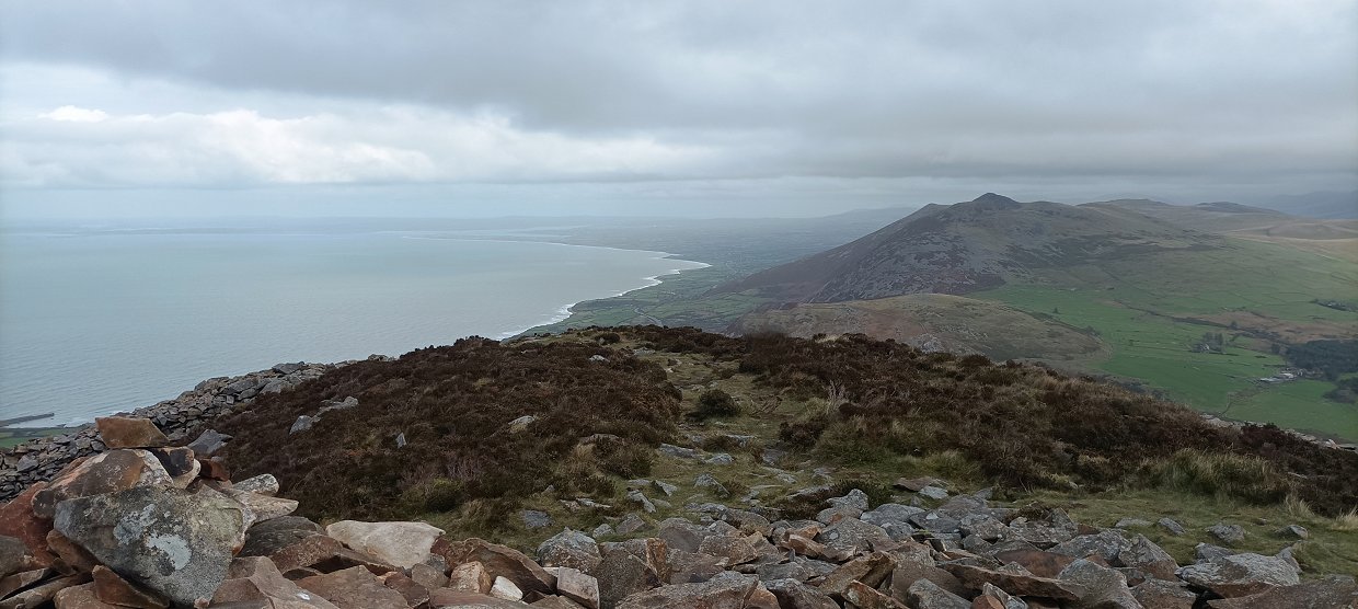
The view south westwards down the coast from the trig point complete with strange addition.
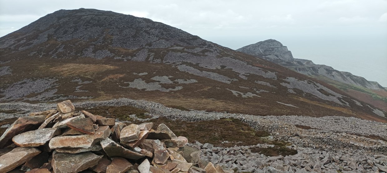
Garn Fôr below. I wouldn't have minded climbing it but I couldn't see any paths on the map down the steep slopes so took a clear track down towards the car.
Tuesday was a lovely day with quite warm sunshine ( when you were out of the wind ) Today we drove up to Mynydd Mawr and had a quick look around before coming back down to a lower car parking space from where we climbed the grassy little hill of Mynydd Gwyddel from where we could see the headland that I would be walking around on my way back to the cottage.
Sue returned to the car whilst I went back down the small valley at the bottom of which is St. Mary's well. The tide was actually further in so again I just had to be content with looking at roughly where it was.
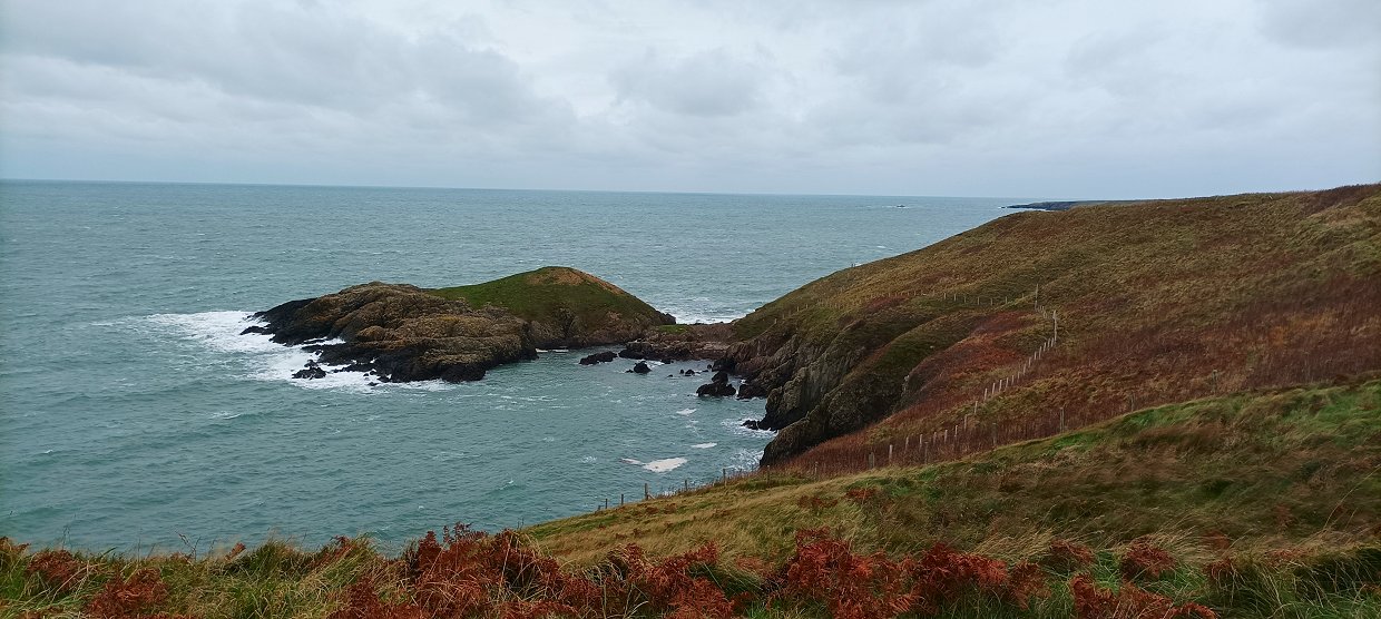
From above the well the coast path takes a higher route around the headland but I'd seen a narrower trod below which looked quite well used so I followed that and got some really great views down to the rugged coastline and sea.
The sea was a beautiful colour.
The trod just above the cliffs.
The trod carries on around the headland until it rejoins the coast path above Porth Felen.
Looking across Porth Felen to Mynydd Bychestyn and Pen y Cil.
And a look back at the coastline just walked from Pen y Cil.
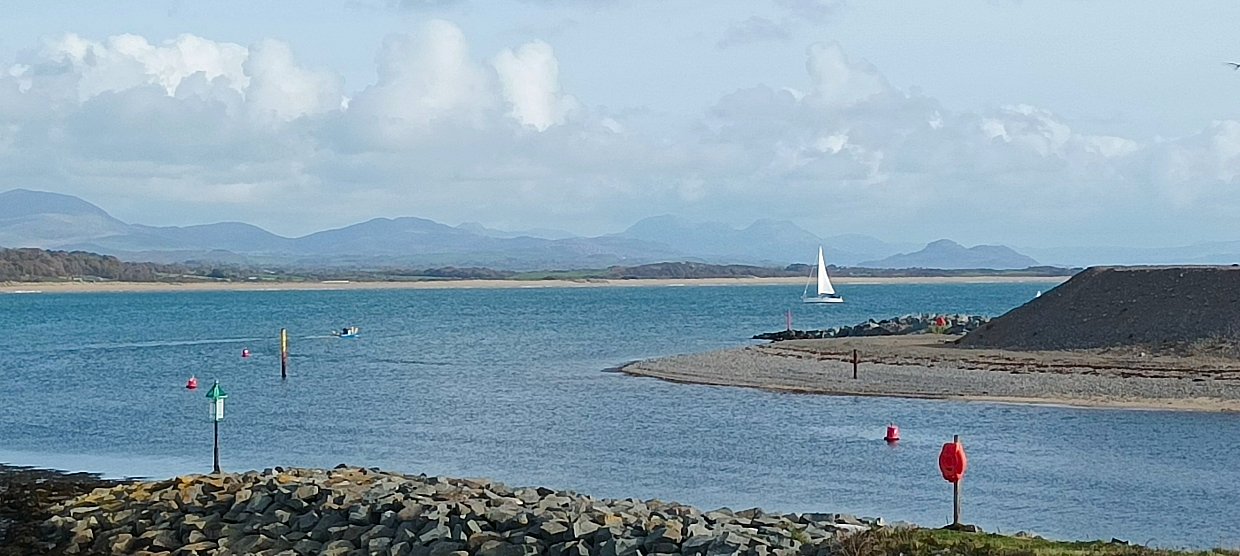
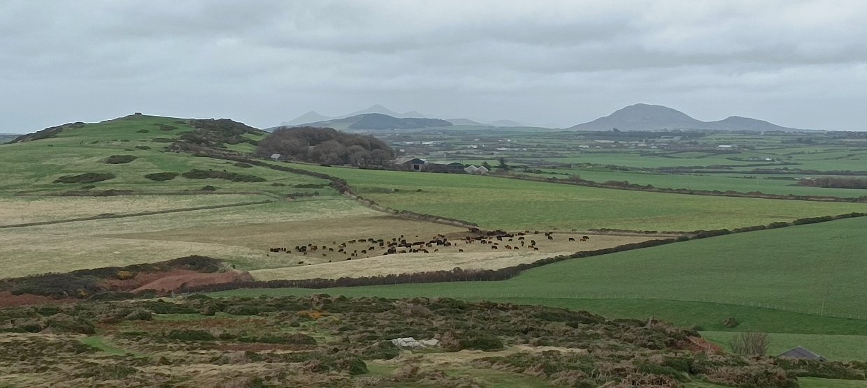
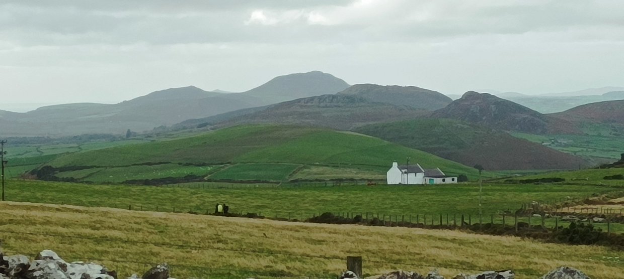
I had to return to work on Thursday so we had a morning in Pwllheli before I caught the train The Rhinog mountains can be seen in the haze.
We had a final stroll on the beach. This is looking down along the coast to Abersoch with St. Tudwal's island clearly seen. I really enjoyed the peninsula, the weather was largely better than we had feared I think this might have been due to the wind which blew everyday it seemed on the whole to blow in better weather.
Previous walk -- Coniston above the clouds - Next walk - Coniston to Greenburn and back